Decision-makers in all sectors are faced with the task of preparing their companies, governments and communities.
The value of being able to prepare for and mitigate risks effectively is massive across all sectors.
-
![Biodiversity]()
Biodiversity
EarthOS can help to progress our understanding of the health and potential stressors on ecosystems. This can be used to pave the way towards more concrete and effective measures against ecosystem and biodiversity loss.
-
![]()
Energy and Infrastructure
Energy producers can use the platform to guide the optimisation of investment in renewables by location based on environmental conditions, as well as being able to identify risks to infrastructure, identify potential markets, and inform strategic planning. EarthOS can be used to predict what areas will increase demand on the grid due the heightened risk of extreme weather events. The platform can also empower guide distribution by providing information on what locations will be more resilient for grid distribution infrastructure in the coming decades.
-
![]()
Finance and Insurance
With climate change causing shifts in extreme weather and associated risks, finance and insurance companies need to ensure their investments are well founded and that their assets are protected. Finance and insurance portfolio managers can use EarthOS to identify what regions or lines of business are likely to become more or less economically viable to invest in or insure over the coming decades. It can also be used to help customers minimize the impact of climate change by guiding mitigation and resilience strategies.
-
![]()
Disaster Risk
Climate change is increasing the frequency and magnitude of extreme events such as droughts, floods, heat waves, bushfires, and storms. To keep pace with the changing nature of disasters, to save lives, and use resources more efficiently, disaster risk managers need to invest more in preparedness, vulnerability reduction, early warning, and early action. EarthOS provides an evidence-base for preparedness actions, and allows coordinators to set automated alerts at local/regional and global levels to trigger forecast-based action.
-
![]()
Scientific Research
Students and researchers can use EarthOS to access and run simulations on high spatial and temporal resolution forecast scenarios through a user-friendly interface. The formula utility enables researchers to combine and compute climate and societal datasets, to examine how they interact over different time scales. Researchers can upload additional datasets, which can then be used for simulations. Researchers use this to develop and test theories, as well as identifying flashpoints that can guide case selection for more detailed studies.
-
![]()
Land Use Planning
Ecosophy’s EarthOS provides high spatial and temporal resolution forecasting that can inform land use planning. The system provides information with sufficient detail to inform planning at the municipal level from various risks including flooding, drought, water scarcity, and heat stress. Visual representations show how risks are likely to progress over the coming decades and centuries. In this way, land use planners can increase resiliency to major climate shifts, and ensure communities are equipped with mechanisms to mitigate and cope with these changes.
-
![]()
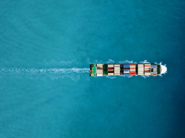
Logistics and Shipping
Changing weather conditions with stronger storms, increased temperatures and sea level rise will impact how logistics and shipping companies operate. EarthOS can be used to: plan more efficient transport routes given the current and predicted environmental conditions; send automated messages about hazardous conditions including icy roads, flooding and storm surge; and enable decision-makers to monitor and mitigate risks, for example deploying temperature-controlled shipping on certain routes.
-
![]()
Defense and Intelligence
Climate change has implications for national security including by affecting global stability, humanitarian crises, military readiness and the risk of conflict. Communities around the world are being impacted by extreme weather events, food and water shortages, and sea level rise. Defence and intelligence personnel can use EarthOS to boost intelligence operations, inform defense planning, and integrate climate change considerations into other critical aspects of situational awareness.
-
![]()
Agriculture and Forestry
Agriculture and forestry users can use EarthOS to predict weather conditions in the short, medium and long term, and plan for ideal harvest times. Automated alerts allow users to identify in advance conditions that negatively impact growth including insufficient precipitation, frost, and the spread of pests. This reduces loss, and allows for the more targeted use of pesticides, irrigation, and fertilizer. Predict areas where tree varieties are likely to thrive under future environmental conditions.
-
![]()
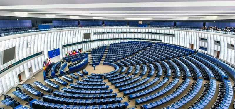
Government
More than ever, governments need to operate on the basis of a clear understanding of their local, regional and global context. Whether planning a new development, reducing greenhouse gas emissions, or negotiating a free trade agreement, EarthOS can help to identify challenges and opportunities. As food security, access to water, and climate migration increasingly affect governments around the world, understanding the future environmental conditions will be critical.
-
![]()
Fisheries and aquaculture
Fishery and aquaculture operators can use EarthOS to plan more efficient routes based on weather and ocean conditions, leading to reductions in costs and emissions. Automated alerts of extreme weather can guide mitigation measures to prevent damage to fishing gear and other infrastructure. The platform can also be used to predict conditions which accelerate harmful algae blooms, the spread of disease, and the movement of invasive species, as well as understanding changes in biomass, enabling more sustainable fishing and aquaculture practices.